
Mapping History

“Who controls the past controls the future. Who controls the present controls the past” –George Orwell
Discussion on Google Maps and Palestinian Rights
Google Maps has been criticized for allegedly prioritizing the spatial narrative of Israel’s occupation, raising concerns about violations of Palestinian human rights and freedom of movement. Critics argue this mapping aligns with the occupying power’s perspective, potentially conflicting with international law, such as Article 49(6) of the Fourth Geneva Convention, which prohibits an occupying power from transferring its civilians into occupied territory. Before exploring this argument, let’s review the relevant known facts.
Quick Historical facts: It was Palestine 2500 years ago… until recent
Herodotus (484 BC – 425 BC), a Greek historian and geographer, was the first to use the term “Palaistinē” (Palestine) in the 5th century BCE to refer to a “district of Syria” between Phoenicia and Egypt. He described it as encompassing both the coastal plain and inland areas, such as the Judean mountains and Jordan Rift Valley, and called its inhabitants “Syrians of Palestine”. It is important to note that Herodotus did not mention Jews or Israelites by name and that his geographical description of “Palestine” is not identical to the modern-day understanding of the region.
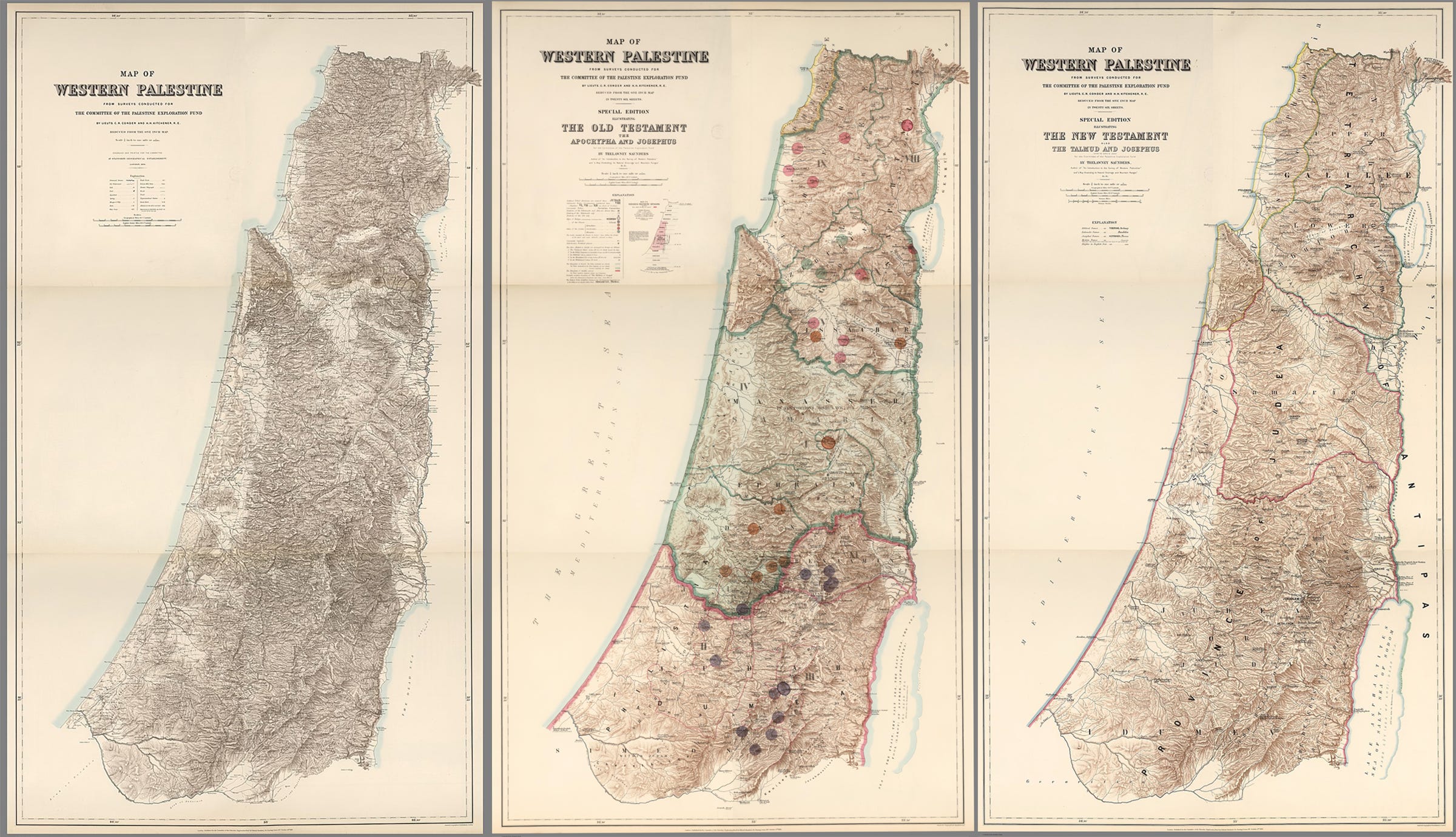
Charles Warren (1840–1927), a British Army officer in the Royal Engineers and archaeologist, led the Palestine Exploration Fund (PEF) surveys from 1867 to 1870. His work laid the foundation for understanding the topography of ancient Jerusalem and the archaeology of the Temple Mount/Haram al-Sharif. The surveys produced a detailed map of Palestine, comprising 26 sheets at a 1:63,360 scale, the most accurate and influential map of the region in the 19th century. It remained the standard until the British Mandate’s Survey of Palestine began in the 1920s.
Warren’s discoveries include the ancient entrance to the Temple platform in Jerusalem, named Warren’s Gate, as well as “Warren’s Shaft” and the “Masonic Hall.” Warren also gained notoriety as a lieutenant involved in London’s “Jack the Ripper” investigation. In 1884, he co-founded the Quatuor Coronati Lodge, the first Masonic research lodge, serving as its inaugural Master. The lodge, still active today, emphasizes evidence-based studies of Freemasonry.
The PEF map delineates Palestine’s geographical boundaries, spanning from southern Gaza to Tyre, Lebanon (formerly Phoenicia) in the north, and from the Mediterranean Sea to the Dead Sea in the south, extending along the Jordan River to Mount Hermon in the north.
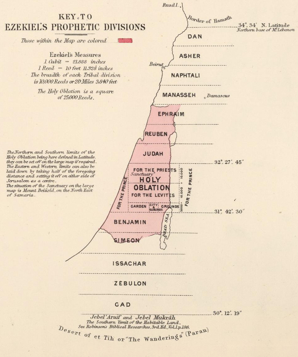
According to the PEF, the Old Testament Book of Ezekiel divides the lands unto the 12 tribes of Israel, with the largest section dedicated to the Holy Oblation, right below its delineation of the 20 mile stretch of Judah, including precise lines of latitude. See below
Jewish Immigration to Palestine: Quick Facts
The term “Jew” originates from “Judah,” referring to the ancient Kingdom of Judah. Today, “Jewish” encompasses people of various heritages, primarily referring to the tribe of Judah. Though some groups, like Kohanim and Levites, claim specific priestly lineage, and others, like Ethiopian Jews, trace descent to tribes such as Dan.
Modern Mass Migration (Late 19th Century–1948)
Jewish immigration to Palestine, known as Aliyah, occurred in distinct waves, driven by religious aspirations, antisemitism, and political developments.
“I prefer to see in our midst nations professing Mohammedanism and paganism rather than Jews. They are rogues and cheats. It is my endeavor to eradicate evil, not to multiply it.” - Peter the Great, Emperor of Russia (1682-1725)
The First and Second Aliyah (1881–1914) were waves of Jewish immigration to Palestine and the United States, primarily driven by Russian Jews escaping persecution and restrictive laws. The pogroms of 1881 was sparked by the assassination of Tsar Alexander II, which added fuel the already enraging fire of racial and religious profiling. Accusations of Jewish involvement with the assassination of Alexander II and exploitative loansharking, spread across Russia. These resulting attacks, combined with the oppressive May Laws and confinement to the Pale of Settlement, prompted many Jews to seek better lives in the United States and Palestine. During these Aliyahs, Jewish immigrants founded key settlements, including Tel Aviv and the first kibbutz, establishing the groundwork for communal living in Palestine.
British Mandate (1922–1947): Jewish immigration surged, especially in the 1930s, due to Nazi persecution in Europe. The Balfour Declaration (1917) supported a Jewish homeland, and the Haavara Agreement (1933) enabled Jewish emigrants from Nazi Germany to transfer assets to Palestine.
The Zionist-Nazi Connection: SS and the Haavara Agreement
Palestinian Authority president, Mahmoud Abbas, in his 1982 thesis and 1984 book The Other Side: The Secret Relationship Between Nazism and Zionism, claims Zionist leaders collaborated with Nazis, sharing Holocaust responsibility to promote Zionism and drive Jewish emigration to Palestine. He suggests blaming Nazis is “half the truth” arguing that Zionists were “fundamental partners” with the Nazis, sharing responsibility for the Holocaust. He posits that Zionists collaborated in the deaths of many European Jews to instill fear, promote Zionism, and drive emigration to Palestine. Pointing to Israel’s 1960 trial and execution of Adolf Eichmann – a Nazi Officer of the Schutzstaffel (SS) and allegedly one of the major organizers of the Holocaust - Abbas suggest a cover-up to silence revelations of Zionist involvement (based on Eichmann’s alleged statements to Life magazine).
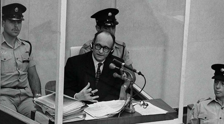
In the 1930s, Eichmann worked with Zionist groups to facilitate Jewish emigration, notably via the 1933 Haavara Agreement, which allowed 60,000 German Jews to move to Palestine with transferred assets. In 1937, Eichmann even toured Palestine to assess the possibility of large-scale Jewish emigration there. Evidence has showed that once the Nazi policy shifted from emigration to extermination, Eichmann chose murder over life. For example, he intervened to sabotage a 1943 plan to transport Jewish women and children from Salonika to Palestine.
In the 1950s, while in Argentina, Eichmann gave extensive interviews to Nazi journalist Willem Sassen, producing tapes and transcripts. In these, he openly discussed his role in mass murder. He also put forward his opinions regarding Zionism, claiming it was responsible for World War II and the subsequent Jewish “supremacy” in post-war German. To much astonishment, during his trial, Eichmann claimed that he was a staunch advocate of Zionism.
Key Mapping Violations: Where in the world is Palestine, now?
Who controls the past controls the future. Who controls the present controls the past
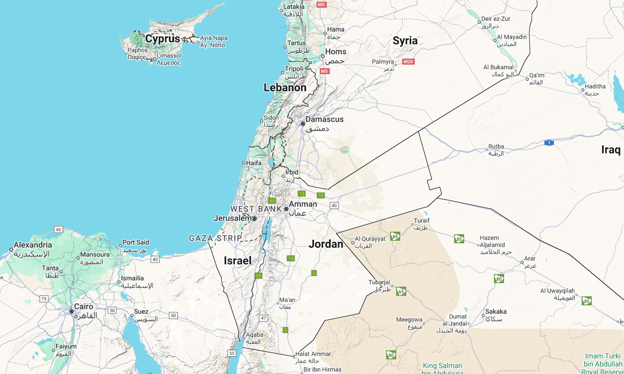
Have you ever googled Palestine? If you do, or have - you would likely not find it on Google Maps (nor Apple Maps). Because Google and Apple are playing the political game, taking orders to rename land as seen fit by those who wish to distort history. Here is the break down:
Recognition of Illegal Settlements: Google Maps label several unauthorized Israeli settlements in the occupied West Bank and treats annexed East Jerusalem as Israel’s capital, legitimizing illegal occupation and erasure of Palestinian geography.
Invisibility of Marginalized Communities: Areas like Khan al-Ahmar, facing demolition and displacement threats, are barely visible unless zoomed in extremely close, aiding their planned removal from both maps and physical land.
Dangerous Route Planning: Navigation features cater to Israeli settlers (whose presence is illegal), often directing Palestinian users into hazardous zones like military areas, checkpoints, and settlements, endangering their safety.
Broader Impacts: These practices shape public opinion to favor Israeli interests, contradicting Google’s human rights commitments. They exacerbate movement restrictions under the Oslo Accords’ Area A/B/C divisions, where Palestinian “islands” in Area C require navigating checkpoints, violating Article 13 of the Universal Declaration of Human Rights (freedom of movement). This limits access to services and stifles economic activity.
The new (perhaps soon to be digital) ID System’s Role: Israel’s color-coded IDs enforce differential treatment:
Blue IDs (for Israelis and some Jerusalem Palestinians): Allow free movement across Israel and Area C; holders fall under civil law (innocent until proven guilty).
Green IDs (for West Bank/Gaza Palestinians): Restrict movement to home territories; require permits elsewhere and subject users to military law (guilty until proven innocent), with a 99% conviction rate in military courts.
The report argues these digital representations perpetuate fragmentation, inequality, and occupation, calling for Google to align mapping with international humanitarian standards.